What Is Tule Fog?
Tule fog is a thick, ground-level radiation fog that forms in California’s Central Valley, mainly in the Sacramento and San Joaquin valleys, during the cool season from late fall through early spring after the first significant rainfall. It takes its name from the tule marshes that historically covered large parts of the region, and it often fills the entire valley floor while hills and mountains above remain clear.
This fog forms on calm, clear nights when the ground rapidly loses heat, cooling the moist air directly above it until tiny water droplets condense near the surface. Because the Central Valley is enclosed by mountain ranges, the cold, dense air becomes trapped, and a temperature inversion develops with warmer air aloft acting as a lid, preventing mixing and allowing the fog to thicken and linger.
Tule fog is especially hazardous because it hugs the surface and can reduce visibility to just a few feet, sometimes for hours or days at a time. Historically, it has been a leading cause of weather-related traffic accidents in California, particularly along major freeway corridors where sudden changes in visibility can catch drivers off guard.
Current Patterns and Why It’s So Persistent
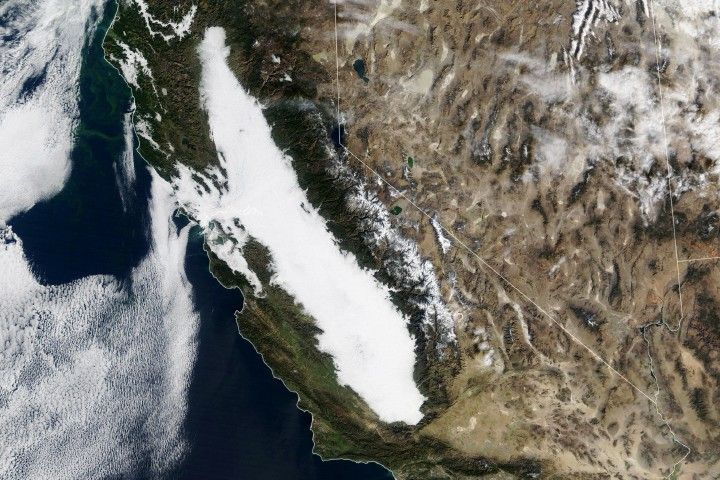
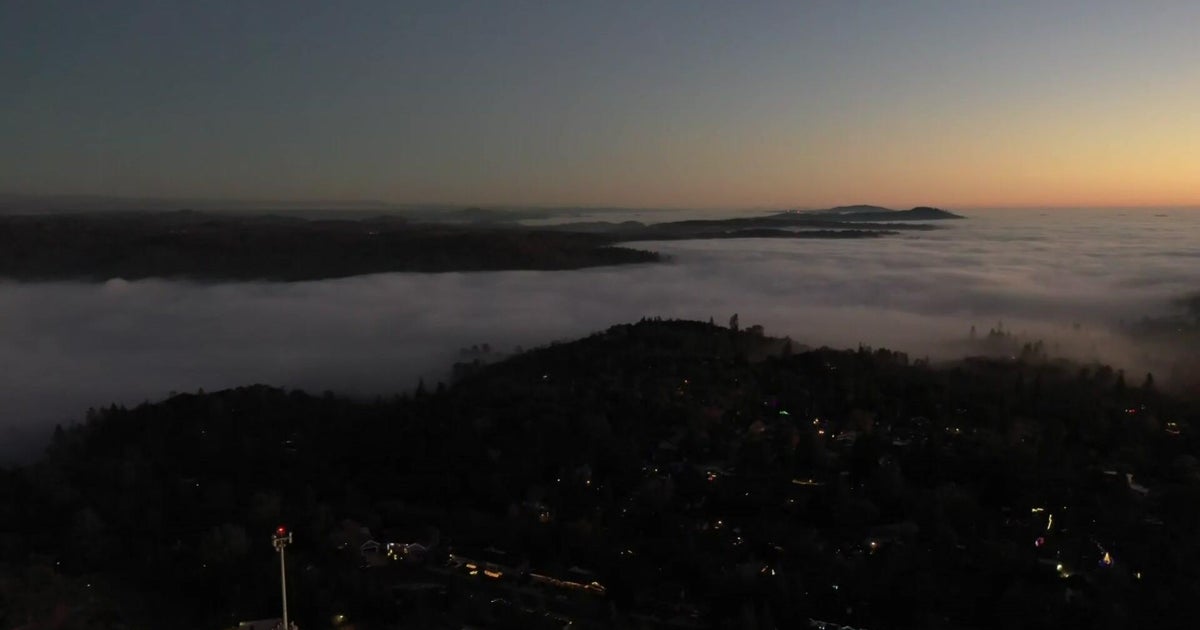
This winter, satellite imagery and ground reports show a sprawling blanket of tule fog stretching roughly 400 miles along the Central Valley, repeatedly forming overnight and persisting through the daytime over much of the region. The fog has been especially entrenched in low-lying urban areas like Sacramento and Fresno, while nearby foothills sit in sunshine just above the fog layer.
The persistence of this event is tied to a very wet autumn that left valley soils and low-level air masses saturated, followed by the development of a strong, stable high-pressure system over California. This setup created a pronounced inversion, with warmer air above and cooler, moist air trapped below, and with little wind or storm activity to disturb the stratified atmosphere, the fog has been able to reform night after night.
Local meteorologists describe the situation as a classic case of the valley being "locked in" beneath a lid of high pressure, with a visible "sunshine line" around 1,000 to 1,200 feet where drivers can literally climb out of the fog into clear blue skies. Forecasts suggest that only a significant shift in the pattern—such as the arrival of a Pacific storm or stronger mixing winds—will finally break up the inversion and clear the fog for more extended periods.
Impacts on Travel, Health, and Agriculture
The most immediate impact of tule fog is on transportation. Highway visibility can drop to near zero in patches, leading to dangerous driving conditions and contributing to pileups in past years, especially along major north–south routes. During the current persistent episode, drivers have faced extended low-speed conditions, while valley airports have experienced delays, diversions, and cancellations due to low ceilings and poor visibility.
For residents, weeks of dim, chilly days can take a psychological toll, amplifying wintertime feelings of gloom and reducing outdoor activity. Health officials often remind people to use headlights, slow down in foggy zones, and be cautious in areas where air quality may stagnate under inversions, especially for those with respiratory conditions.
In agriculture, tule fog has a more mixed impact. On the positive side, the cool, shaded conditions help fruit and nut orchards accumulate winter chill hours that are essential for proper bud development and yield in the following season. On the other hand, prolonged fog and low clouds can suppress daytime temperatures and solar radiation, raising heating demand, reducing solar power output, and occasionally complicating field operations and crop management schedules.
Long-Term Trends in Tule Fog
Although this winter’s event feels intense and long-lived, long-term research indicates that tule fog has become less frequent over recent decades. Analyses of historical records show that fog days increased through much of the 20th century, likely linked to rising air pollution, then declined sharply from the 1980s onward as emissions controls improved air quality and broader warming trends altered winter temperature and moisture patterns.
Scientists have found that tule fog occurrence closely tracks air pollution levels: when particulate pollution is higher, there are more tiny surfaces for water droplets to form around, which can enhance fog formation. As cleaner-air regulations took hold and some winters became warmer and drier, the number of dense fog days in the Central Valley dropped, even though year-to-year variability remains large.
This season’s stubborn stretch of fog underscores that, despite the long-term decline, the Central Valley can still see classic, high-impact tule fog when the right ingredients line up: ample soil moisture from recent storms, long nights and clear skies, light winds, and a strong inversion under high pressure. For residents, planners, and growers, that means winter awareness and adaptation to tule fog remains an important part of life in the valley.